 By OUR CORRESPONDENT
Salalah – The Digital Educational Atlas of the Sultanate of Oman was launched at the 11th International Conference on Geo-Advances in Geographic Information (GeoAdvances 2026) in Salalah on Monday.
Organised by the Ministry of Education (MoE) in cooperation with the University of Technology Malaysia (UTM) and the University of Dhofar, the two-day conference brings together researchers and experts from Oman and abroad to discuss developments in geographic information and geospatial technologies.
The opening ceremony at the University of Dhofar was held under the patronage of Sheikh Salim Mustahail Al Maashani, Advisor at the Diwan of Royal Court.
Dr Suleiman Abdullah Al Jamoudi, Director-General of Vocational and Technical Education at MoE and Deputy Chairman of the conference’s Organising Committee, said the event features 71 scientific projects, including 46 oral papers and 25 research posters.
Seven keynote speakers are taking part, delivering six keynote lectures, while 20 governmental, private and academic institutions are participating across 12 parallel scientific themes. Omani participation includes 40 projects, comprising 22 scientific papers and 18 research posters.
Al Jamoudi said hosting the conference in Oman provides a platform for scientific dialogue and knowledge exchange and strengthens cooperation between academic, research and professional institutions.
He said the MoE seeks to keep pace with advances in geographic information by expanding the use of geographic information systems and modern technologies in education, particularly in social studies curricula.
The ministry has also developed related digital initiatives and projects through the Modern Geographic Technologies Committee and its programmes.
Prof Elias Abdul Rahman, speaking on behalf of UTM, highlighted joint academic and scientific cooperation with Omani institutions in geographic information and geospatial technologies. He also stressed the importance of integrating modern technologies and innovations with practical applications.
The Digital Educational Atlas of the Sultanate of Oman combines geography, history and spatial technologies in a digital educational platform.
The atlas supports the use of digital data and maps in education and is designed to improve students’ analytical and spatial thinking skills while linking classroom knowledge with digital applications and future skills.
The conference’s opening programme included a presentation on modern geographic technologies in school and higher education and the ministry’s efforts to develop their use.
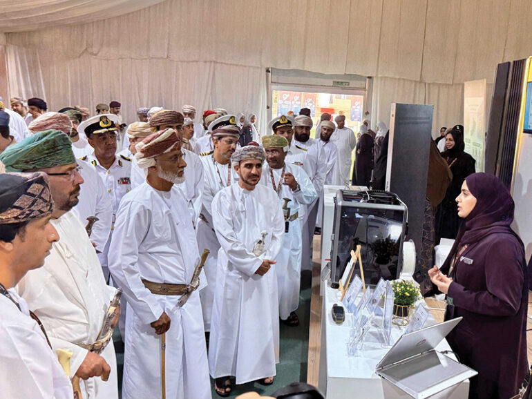
An accompanying exhibition, featuring 20 governmental, private and academic institutions, is showcasing projects, devices, systems and scientific programmes related to geographic information and geospatial technologies and their applications.
The first day featured four scientific sessions covering spatial technologies in school curricula, modern surveying devices, GIS-based interactive educational solutions, and the role of geographic information systems in sustainable tourism in line with Oman Vision 2040.
The conference aims to facilitate international knowledge exchange, transfer advanced technologies to national institutions and build sustainable research partnerships between universities and research centres.
It also supports the integration of geographic technologies into curricula, applied learning and spatial analysis, while promoting data-driven decision-making, sustainable development, resource management and environmental solutions.
The conference further seeks to develop national expertise through training programmes, encourage investment and innovation in geographic technologies, and strengthen Oman’s regional and international position in the sector.
© 2021 Apex Press and Publishing. All Rights Reserved. Powered by Mesdac